Welcome to Harthill with Woodall
CLICK FOR 2021 CENSUS DATAIntroduction
Harthill is a village in the Metropolitan Borough of Rotherham (part of South Yorkshire, England), on the border with Derbyshire. It lies between Killamarsh and Thorpe Salvin, and is located at approximately 53°19′10″N 1°15′30″W, at an elevation of around 110 metres above sea level. In the 2001 census, the civil parish of Harthill with Woodall had a population of 1,909, reducing slightly to 1,879 at the 2011 Census.Harthill is traditionally an agricultural village, although there is also a history of quarrying whetstones for use in knife-sharpening. The parish church of All Hallows dates from 1085, when it was commissioned by William de Warenne. The tower is 14th century. The Dukes of Leeds, major landowners in the area, and their families, are interred in the crypt. Harthill has two public houses: the Beehive and the Blue Bell. Harthill is the principal village in the civil parish of Harthill with Woodall. The parish also contains Harthill Reservoir, which feeds the Chesterfield Canal, Nor Wood, and the hamlet of Woodall with its M1 motorway service station. The reservoir was constructed in 1796 and in 2020 the Canals and Rivers Trust announced a £5 million programme of works to upgrade the overflow spillway of the earth dam. The reservoir provides leisure facilities for Rotherham Sailing Club, Yorkshire Outdoor Swimmers and fishing. The village is served by several public transport routes. First South Yorkshire operate the hourly service X54 to Sheffield from Monday to Saturday, with TM Travel operating it on Sundays. First also run service 29 to Rotherham between Monday and Saturday, with TM Travel operating service 29a on evenings and Sundays. Stagecoach also operate the circular route 26/26a during Monday to Saturday daytime, connecting Harthill with Crystal Peaks. There is also a 1-a-day service to the Hallamshire Hospital in the form of service X30; this is run by TM Travel, Monday to Saturday at 7 am.
Parish Information
Parish statistics
Area |
1,231 hectares |
|---|---|
Population |
1,923 (2021) |
Density |
156 people/km2 |
Mean age |
45.8 |
Ward |
Wales |
District |
Rotherham |
Postcodes |
S26 |
ONS ID |
E04000109 |
Council
Contact details for Harthill with Woodall Parish Council, including current councillors, precept data and election results.
Education
View educational establishments in Harthill with Woodall Parish. Data includes OFSTED rating and current appointed governors.
Business
Business directory listing local businesses operating within Harthill with Woodall Parish.
Planning
View recent planning applications submitted for Harthill with Woodall Parish.
Property
Price paid data for all property sold in Harthill with Woodall Parish since 2018. Includes average prices for each property type.
Heritage
Local heritage sites, historic churches, heritage pubs plus local heritage initiatives for Harthill with Woodall Parish.
Local News

Hosted and licensed by BBC
Harthill shop owners fear for future over latest road closures
Published: 10th Aug 2023

Hosted and licensed by Yorkshire Live
'Nightmare' in posh Yorkshire village facing five months of roadworks
Published: 8th Oct 2023

Hosted and licensed by Rotherham Metropolitan Borough Council
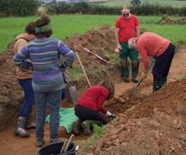
Harthill in the Bronze Age – Rotherham Metropolitan Borough Council
Published: 20th Sep 2022